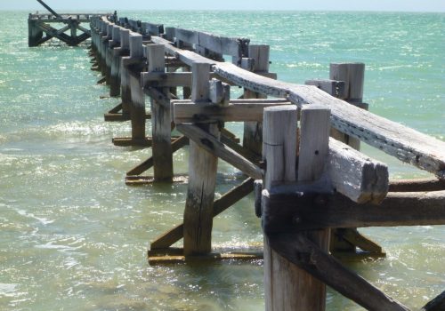
Wooramel Coast
This low lying coastline is home to Shark Bay’s most extensive mangrove community. The North West Coastal Highway runs parallel to the Wooramel Coast and short unsealed access roads connect it to coastal sites.
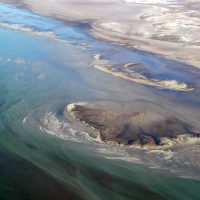
A scenic lookout at White Bluff just off the highway south of the Gladstone turnoff gives some insight into the massive size of Shark Bay with views across the shallow intertidal area towards Hamelin Pool and Faure Sill.
Camping at Gladstone, Bush Bay, and New Beach is administered by:
Shire of Carnarvon
Francis Street
PO Box 459
Carnarvon WA 6701
Ph: (08) 9941 0000
Fax: (08) 9941 0099
Email: shire@carnarvon.wa.gov.au
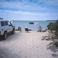
Bush Bay and New Beach are all within 40km of Carnarvon. There is no fresh water, fuel, food or other supplies or facilities at these sites. Only campervans with chemical toilets are allowed to camp here. Dogs are permitted on leads only.
Visitor pressures in these areas have had a negative effect on the local environment, particularly the mangroves. Please tread lightly and take all your rubbish out with you.
Gladstone is about 110km south of Carnarvon and has some basic facilities including composting toilets, a boat ramp and an informal camping area. There is a gate between the highway and Gladstone – please keep this closed at all times. Camping fees apply and can be paid into the honesty box on-site or to staff at the shire office in Carnarvon.
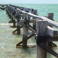
Gladstone was an important port for many years from the early 1900s when boats freighted wool and sandalwood to ports further south. You can see relics of the port facility constructed in 1910. Lighters used the port to collect wool and sandalwood brought by teams of camels from stations throughout the Murchison district.
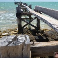
The most obvious structure is the causeway and jetty, the remains of what was the most substantial wool-lightering structure on the Western Australian coast. The 287 metre stone causeway lead from a wool-store shed to a 77 metre timber jetty. The footings of the wool-store can still be seen today.
For your own safety please keep off the remains of the jetty.
Fishing is possible along this section of coastline although fishing is generally better in the deeper waters offshore. You can launch boats from the beach at Bush Bay or the boat ramp at Gladstone.
There are special zoning restrictions along this section of coastline:
- Gladstone Special Protection Zone restrictions help conserve the local population of dugongs which visit the area to breed during summer:
Waters south of the Gladstone boat ramp are closed to boating from 1 September to 15 January.
Waters north of the ramp are closed between 1 December and 31 March. - Disappointment Reach Special Protection Zone north of Gladstone is closed to fishing all year as a benchmark for monitoring the health of marine ecosystems. It is also important dugong habitat.
- The Wooramel Special Purpose Zone recognises the significance of the Wooramel seagrass bank in the Shark Bay ecosystem. Take care not to disturb turtles, dugongs and seagrasses.
See the zoning maps in the Shark Bay Marine Reserves brochure for details.
Fishing regulations are also in place. Visit the Fisheries website for more information.

