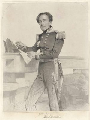
1858 Henry Mangles Denham
The town of Denham is named in honour of Captain Henry Mangles Denham who spent three months charting Shark Bay in 1858. Denham’s hydrographical survey was conducted partly in an effort to find alternative locations for convict settlements and was the longest running survey ever commissioned by the Royal Navy. The project ran from 1852 to 1861 and produced charts so accurate they were still being used in the 1960s.
Denham’s survey work was conducted from HMS Herald, a square-rigged wooden frigate. Landings were made at numerous locations, including Little Lagoon, Cape Lesueur, Hamelin Pool and Herald Bight. At Quoin Bluff on Dirk Hartog Island, Denham found the remnants of the garrison established in 1850 to protect the guano trade.
He managed to navigate the shallow waters of both the eastern and western gulfs and named several islands including Pelican, Smith, Wilds and Egg islands. Salutation Island was so named after a friendly encounter with Aboriginal people who were invited on board the Herald and given gifts. But the names Hopeless Reach, Disappointment Loop and Disappointment Reach suggest Denham’s work was also full of frustrations.
Denham’s survey is remembered with the Denham Channel leading to Shark Bay and Denham Sound which provides anchorage for large vessels. Denham also quite literally put his name on the landscape at Eagle Bluff where the words “HERALD DENHAM 1858” were carved into the limestone cliff. When this section of rock broke away from the cliff it was moved to the township, and is now on display in Denham’s Pioneer Park.

